Trail Walking Kastelruth - Castelrotto - Seiser Alm - Refuge Tierser-Alpl - Photo
© OpenStreetMap contributors
Length
Length
14.7 km
Max alt
Max alt
2495 m
Uphill gradient
Uphill gradient
605 m
Km-Effort
Km-Effort  
23 km
Min alt
Min alt
1835 m
Downhill gradient
Downhill gradient
765 m
Boucle
Boucle
No
Creation date :
2023-07-20 08:31:45.083
Updated on :
2023-07-21 11:47:55.873

(0 Reviews)

Walking
Walking
5h12
Difficulty : Difficult

Scan this QR Code to open this trail in the SityTrail application

FREE GPS app for hiking

Logo SityTrail SityTrail

IGN / Geographical institutes

Download SityTrail from the App Store Download SityTrail from Google Play

Logo SityTrail SityTrail World

The world is yours!

Download SityTrail from the App Store Download SityTrail from Google Play Download SityTrail on Huawei AppGallery

About

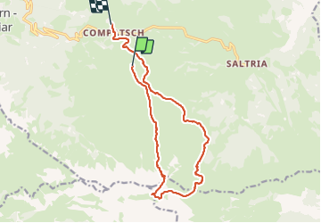
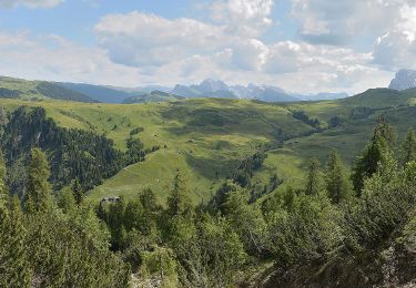
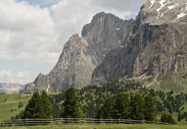
Trail Walking of 14.7 km to be discovered at Trentino-Alto Adige/Südtirol, South Tyrol, Kastelruth - Castelrotto. This trail is proposed by VacheKiri67.

Description

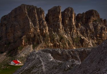
Faite le 20/07/2023. D'après "Rother : Dolomiten 1 - 39 Von der Seiser Alm zur Tierser-Alpl-Hütte". Durée indiquée pour le circuit : 4h30. Montée au Seiser Alm depuis Seis par la télécabine Kompatch, puis prendre le télésiège Panorama. La randonnée est difficile car longue et la montée en lacets à la Roszahn-scharte est rude ! Bonnes chaussures indispensables.

Elevation profile

Photos

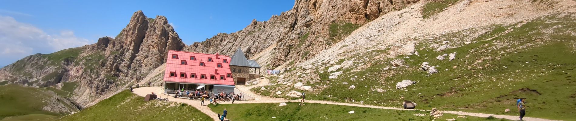
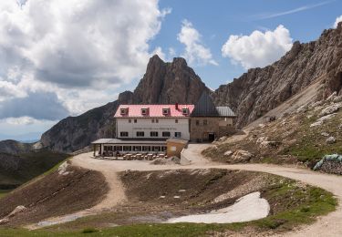
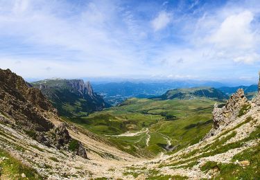
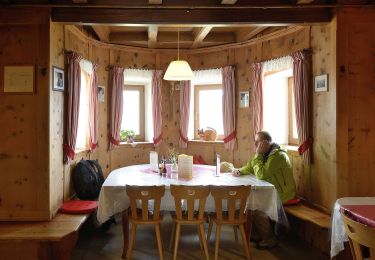
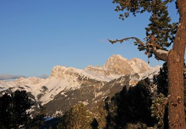
66 photos in total. Please click on a photo to see them all in the gallery.

Positioning

Country:
Italy
Region :
Trentino-Alto Adige/Südtirol
Department/Province :
South Tyrol
Municipality :
Kastelruth - Castelrotto
Location:
Unknown
Start:(UTM)
701320 ; 5156430 (32T) N.

Trails nearby

Trail On foot Tiers - Tires - (SI C19N) Rifugio Alpe di Tires - Rifugio Sasso Piatto - Photo
On foot
PRO

On foot

Easy
Tiers - Tires, Trentino-Alto Adige/Südtirol, South Tyrol, Italy
6.4 km | 9.7 km-effort
2h 12min
No
Trail On foot Völs am Schlern - Fiè allo Sciliar - (SI C18N) Rifugio Bolzano - Rifugio Alpe di Tires - Photo
On foot
PRO

On foot

Easy
Völs am Schlern - Fiè allo Sciliar, Trentino-Alto Adige/Südtirol, South Tyrol, Italy
5.5 km | 9.4 km-effort
2h 7min
No
Trail On foot Kastelruth - Castelrotto - IT-5 - Photo
On foot
PRO

On foot

Easy
Kastelruth - Castelrotto, Trentino-Alto Adige/Südtirol, South Tyrol, Italy
5 km | 8.6 km-effort
1h 56min
No
Trail On foot Völs am Schlern - Fiè allo Sciliar - Touristensteig - Photo
On foot
PRO

On foot

Easy
Völs am Schlern - Fiè allo Sciliar, Trentino-Alto Adige/Südtirol, South Tyrol, Italy
10.5 km | 15.7 km-effort
3h 34min
No
Trail On foot Tiers - Tires - IT-3A - Photo
On foot
PRO

On foot

Easy
Tiers - Tires, Trentino-Alto Adige/Südtirol, South Tyrol, Italy
4.6 km | 13 km-effort
2h 57min
No
Trail On foot Kastelruth - Castelrotto - IT-9 - Photo
On foot
PRO

On foot

Easy
Kastelruth - Castelrotto, Trentino-Alto Adige/Südtirol, South Tyrol, Italy
10.3 km | 18.3 km-effort
4h 9min
No
Trail On foot Tiers - Tires - IT-3 - Photo
On foot
PRO

On foot

Easy
Tiers - Tires, Trentino-Alto Adige/Südtirol, South Tyrol, Italy
6.7 km | 10.8 km-effort
2h 27min
No
Trail On foot Kastelruth - Castelrotto - IT-2 - Photo
On foot
PRO

On foot

Easy
Kastelruth - Castelrotto, Trentino-Alto Adige/Südtirol, South Tyrol, Italy
5.1 km | 10.6 km-effort
2h 24min
No
Trail On foot Kastelruth - Castelrotto - Hans und Paula Steger Weg - Sentiero Hans e Paula Steger - Photo
On foot
PRO

On foot

Easy
Kastelruth - Castelrotto, Trentino-Alto Adige/Südtirol, South Tyrol, Italy
8.8 km | 12.5 km-effort
2h 50min
No


Close
My subscriptions